Explore the incredible transformation of our planet with NASA’s striking images documenting the dramatic changes on Earth over time. Witness the astonishing evolution from then to now, capturing the Earth’s ever-changing landscape. Discover the jaw-dropping visual journey showcasing the planet’s remarkable transition through NASA’s lens.
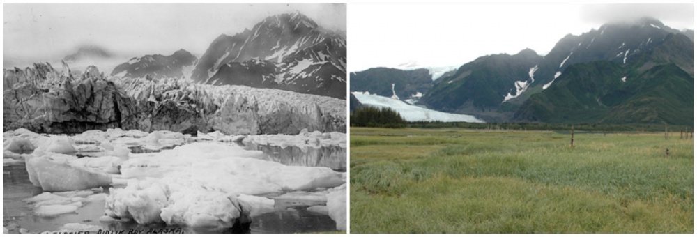
If you compare some of the photographs on NASA’s website, you can see how human beings have changed the appearance of our world over the years. The time difference between these earth images ranges from five to 100 years—incredible.
Pedersen Glacier, Alaska. Summer, 1917 — Summer, 2005
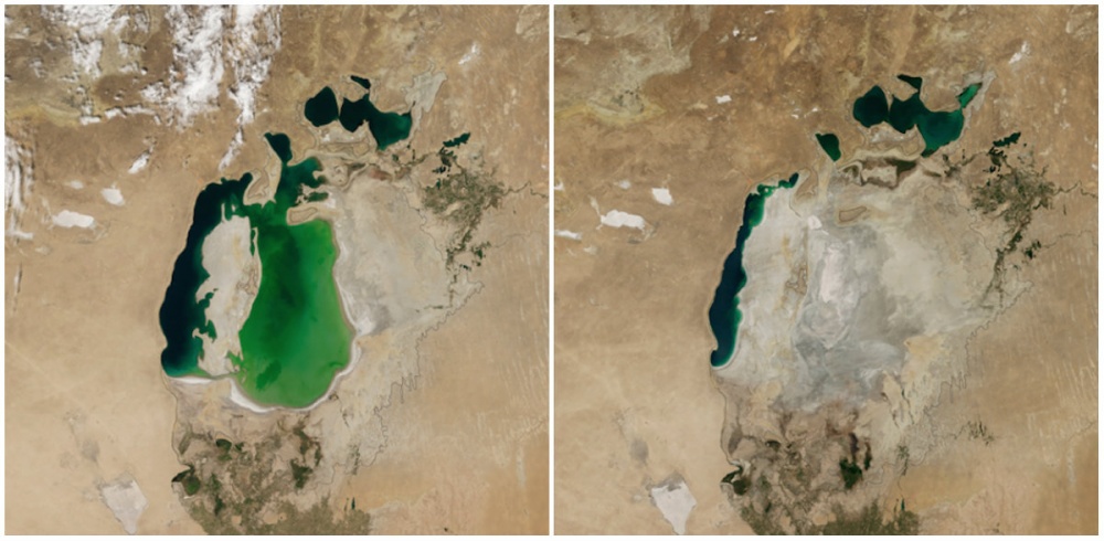
Aral Sea, Central Asia. August, 2000 — August, 2014
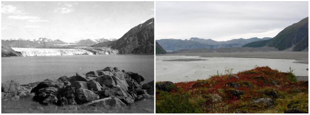
Carroll Glacier, Alaska. August, 1906 — September, 2003
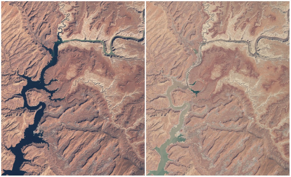
Powell Lake, Arizona, And Utah. March, 1999 — May, 2014
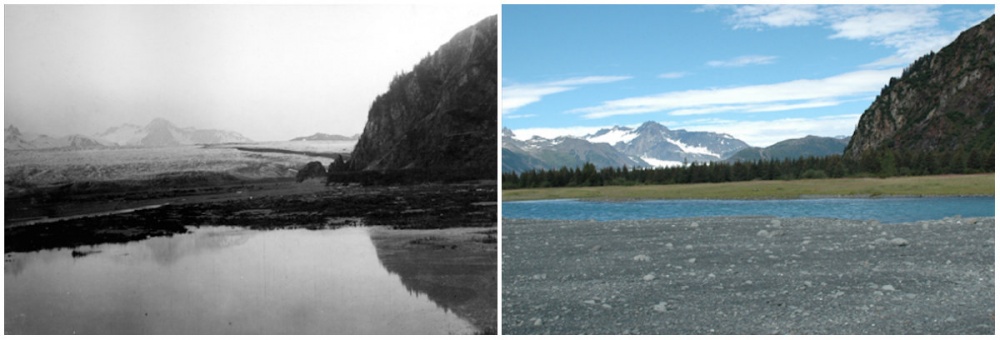
Bear Glacier, Alaska. July, 1909 — August, 2005
Forests In Rondonia, Brazil. June, 1975 — August, 2009
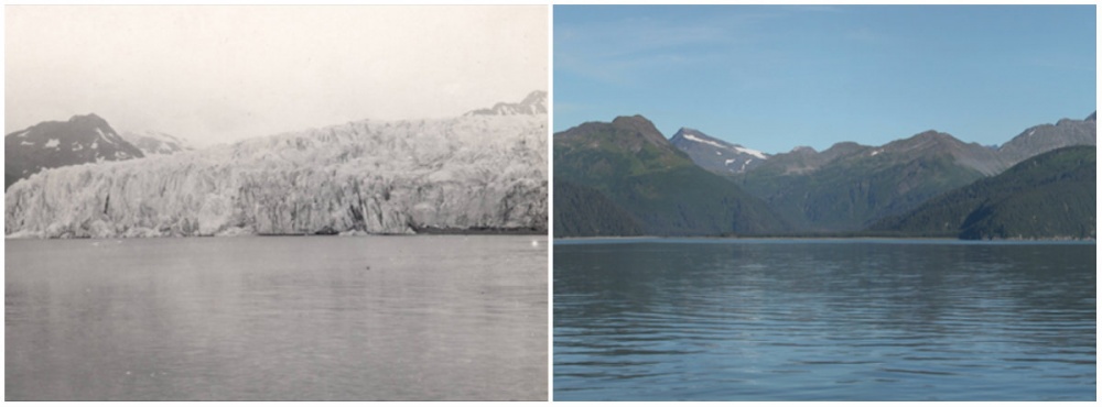
McCarty Glacier, Alaska. July, 1909 — August, 2004
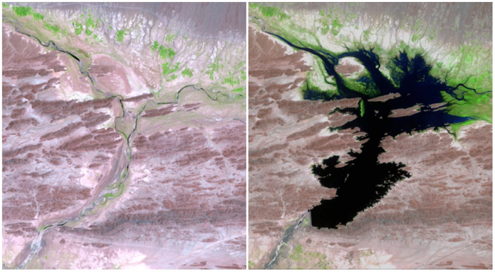
The Dasht River, Pakistan, August 1999 — June 2011.
The Mirani Dam supplies clean drinking water and power to the surrounding area and helps support local agriculture.
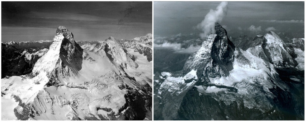
Matterhorn Mountain Is In The Alps, On The Border Between Switzerland And Italy. It Was There From August 1960 To August 2005.
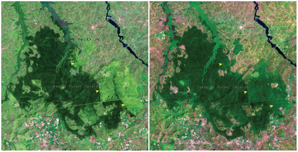
Mabira Forest, Uganda. November, 2001 — January, 2006.
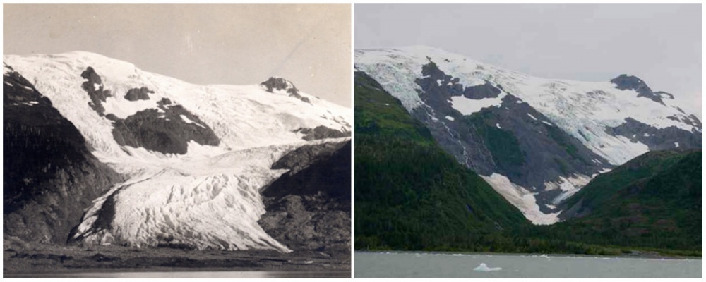
Toboggan Glacier, Alaska. June, 1909 — September, 2000.
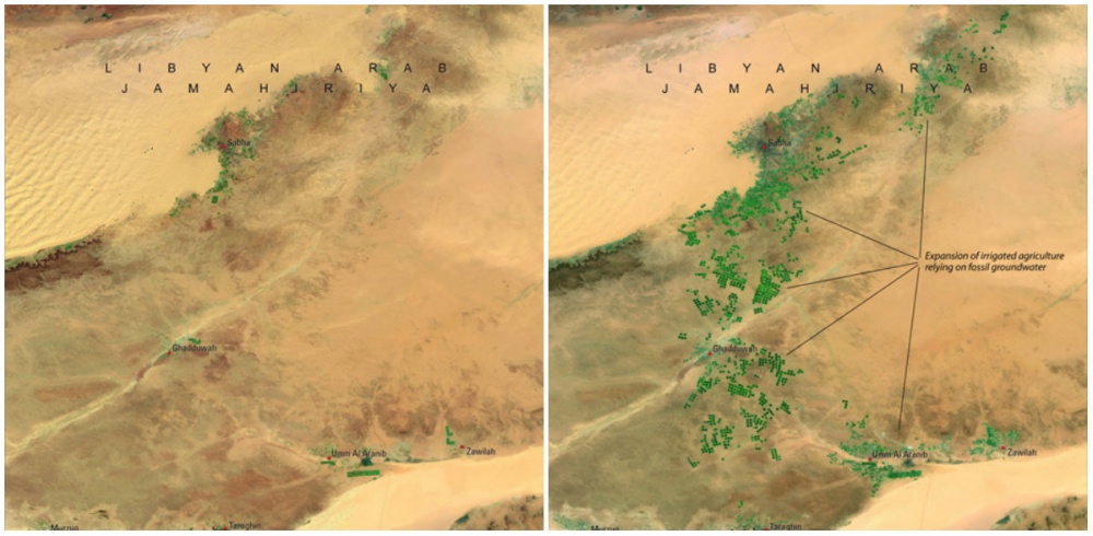
Great Man-Made River, Libya, April, 1987 — April, 2010.
This is the most fantastic engineering project in the world: a network of pipes, aqueducts, and wells more than 500 meters deep. The water system provides water to the desert area.
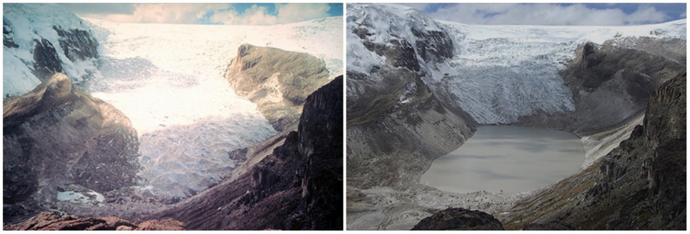
Qori Kalis Glacier, Peru. July, 1978 — July, 2011.
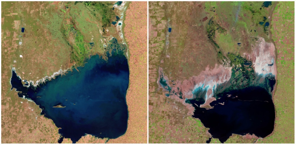
Mar Chiquita Lake, Argentina. July, 1998. — September, 2011.
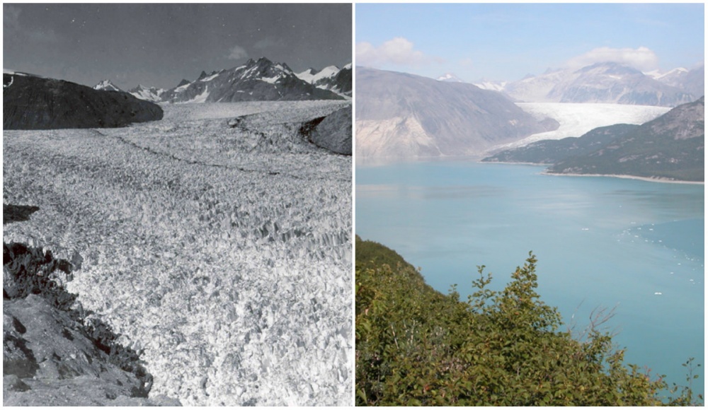
Muir Glacier, Alaska. August, 1941 — August, 2004.
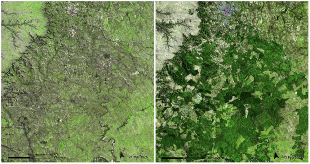
Uruguay Forests, March, 1975 — February, 2009.
Uruguay has grown its forested area from 45,000 hectares to 900,000 hectares. However, this has resulted in a loss of plant and animal diversity.
Like what you’re reading? Subscribe to our top stories.













Discussion about this post